PiCraft Aerial Consulting
At π-Craft, our FAA Part 107–certified pilots specialize in delivering professional, precision-driven UAS operations across a wide range of industries. Whether supporting real estate development, large-scale construction, aerial surveying, or environmental analysis, we provide the data and visual intelligence needed to move projects forward with confidence.

We approach every mission with a commitment to accuracy, reliability, and safety. Our workflows are built for efficiency from pre-flight planning and airspace compliance to advanced post-mission data processing—ensuring every deliverable meets the highest standard of quality and usability.
Collaboration is at the core of how we operate. We align our aerial capabilities with your goals, timelines, and technical requirements, acting as a trusted extension of your team—whether you're a developer, project manager, engineer, or conservation specialist.
At π-Craft, we don’t just deliver images or data points—we deliver clarity, insight, and confidence. We’re here to support your project at every phase, with a focus on building long-term partnerships rooted in trust and performance.
Let’s elevate your next project—get in touch with π-Craft Aerial Consulting today.


Services
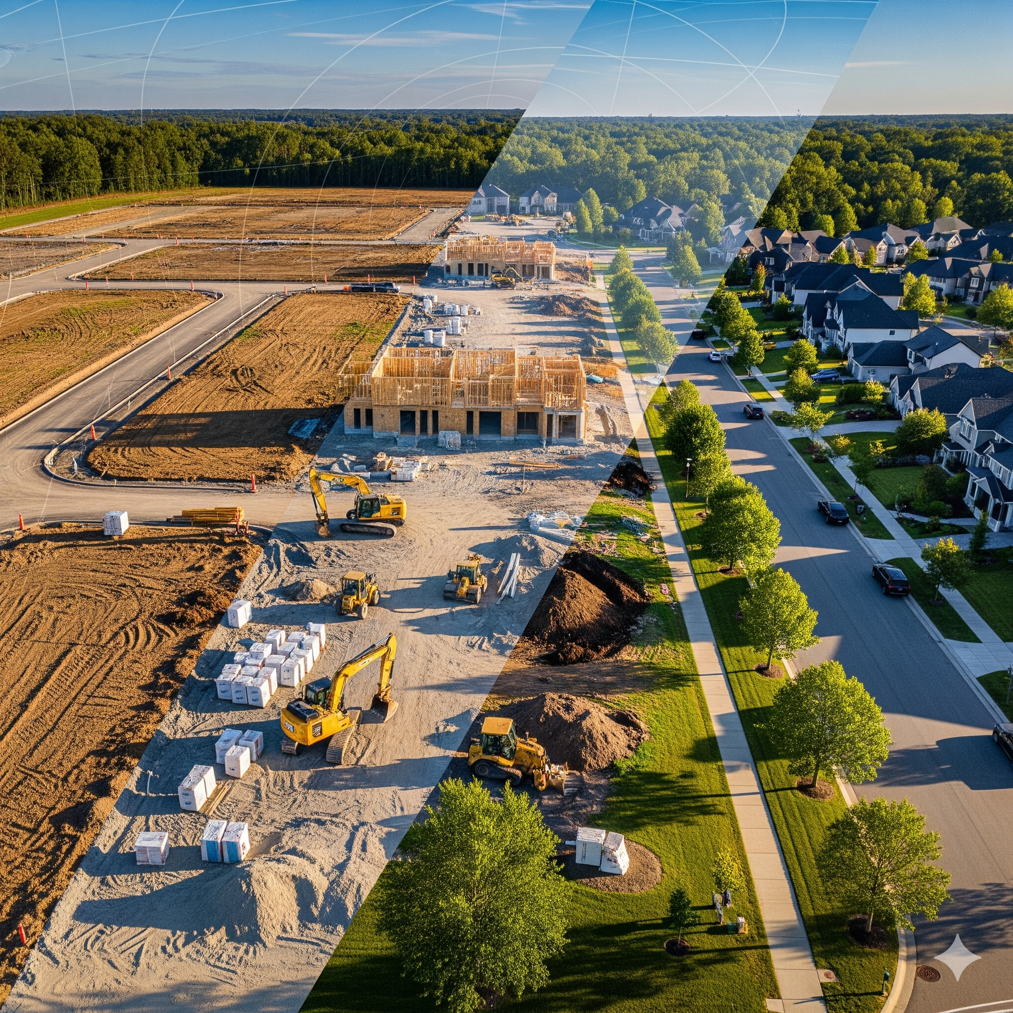
🏗️ Construction & Infrastructure
From groundbreaking to project completion, our aerial solutions keep construction moving with clarity and precision. Pre-construction site surveys lay the foundation with accurate data, while progress monitoring and reporting ensure stakeholders stay aligned every step of the way. We measure stockpile volumes with accuracy that reduces costly guesswork, and generate detailed 2D/3D maps to support planning, compliance, and quality control. Our drone services deliver the actionable insights you need to build smarter, faster, and with fewer surprises.
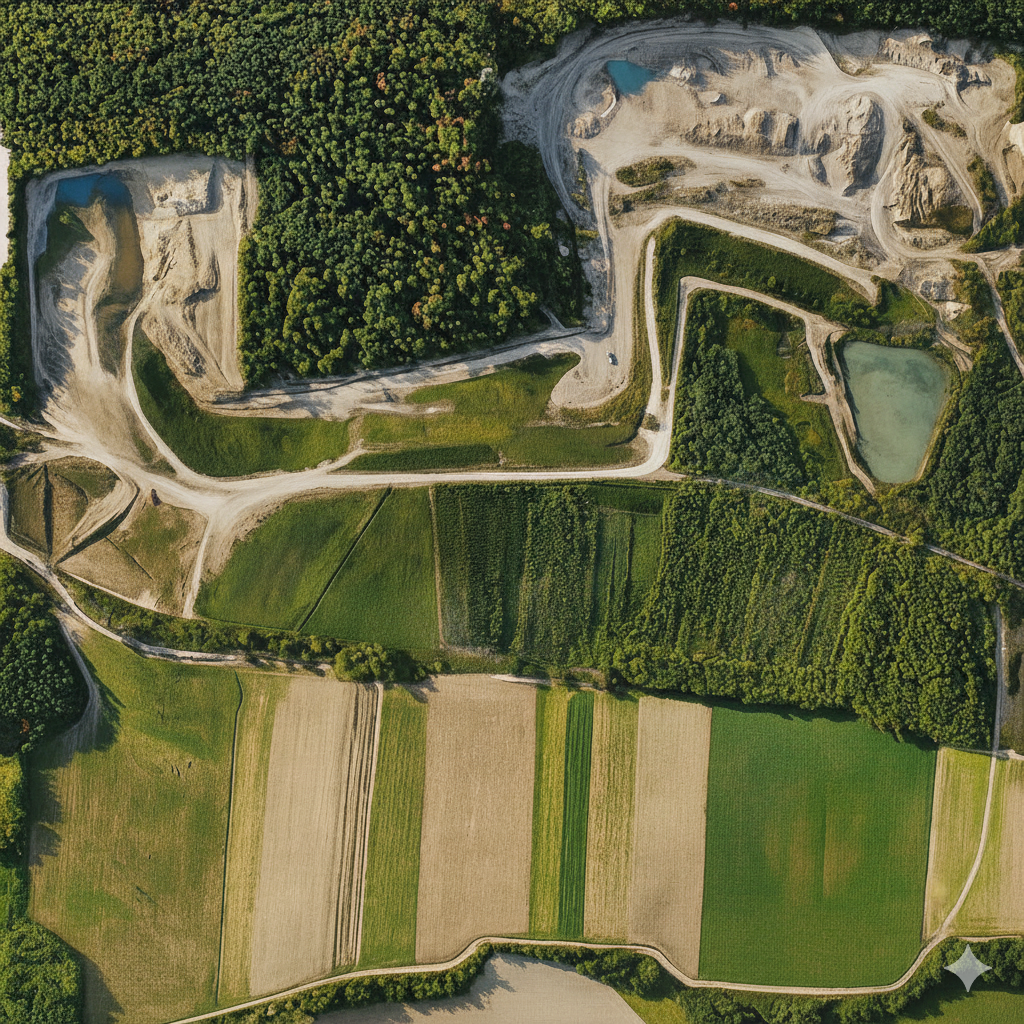
🌿 Environmental & Land Management
Our aerial services provide a bird’s-eye view of natural landscapes, delivering precise, actionable data for sustainable land stewardship. Erosion and sediment control mapping helps mitigate soil loss before it becomes a problem, while wetland and wildlife habitat monitoring supports conservation and regulatory compliance. Floodplain and watershed mapping identifies risk areas to inform planning and protection strategies, and post-disaster damage assessment allows rapid response and recovery. With our drone solutions, environmental managers and landowners gain the insights needed to protect, preserve, and manage resources effectively.

🔍 Inspection & Asset Monitoring
From rooftops and towers to solar fields and utility networks, our aerial inspections deliver safe, precise, and cost-effective insights. Using high-resolution imaging and thermal sensing, we uncover issues invisible to the naked eye — from faulty panels to hidden structural weaknesses. Whether it’s safeguarding infrastructure, assessing environmental damage, or streamlining maintenance planning, our drone services provide clear, data-rich reports that help you make confident, proactive decisions.
🌇 Real Estate & Urban Planning
Our drone solutions give developers, investors, and planners a comprehensive perspective on property and urban landscapes. We provide accurate aerial visualizations for design, renovation, or investment decisions. Zoning and land use overlays reveal regulatory constraints and opportunities, while pre-construction property mapping ensures every project starts on solid ground. Cinematic flyovers and virtual tours bring properties to life, showcasing potential and creating immersive experiences that engage stakeholders. Become better informed with our aerial insights, planning and development.
🎉 Special Events & Projects
From sporting events to social gatherings and outdoor adventures, our aerial coverage captures every angle with clarity and impact. Whether it’s documenting a milestone, showcasing an experience, or creating dynamic promotional content, drone visuals add a cinematic perspective that ground-level cameras simply can’t match. Our services deliver high-quality footage and data-driven insights to enhance event storytelling, audience engagement, and post-event analysis:

